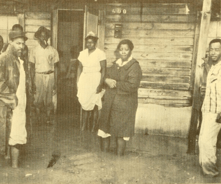
I have used the 1951 Fayetteville, NC city directory and a 1963 federal study of urban blight to overlay patterns of segregation and neglect onto a modern map of the city.
Unpaved Lines: Blight and Race in Fayetteville at Mid-Century (link opens in new window)
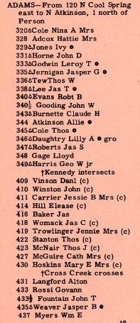
All streets within the city limits which, in 1951, were listed as being 100% “colored” are highlighted on the map. Clicking on those streets will often show more detail including screen captures of the 1951 city directory which used the designator (c) to indicate a “colored” household. This designator was used to determine which streets were entirely “non-white.”
Highlighted areas on the map show neighborhoods that, in 1963, were more than 75% “non-white.” Clicking on those areas will show more detail.
The 1951 city directory can be found here: Hill’s 1951 Fayetteville, NC City Directory (link opens in new window)
The 1963 Neighborhood Analysis can be found here: Neighborhood analysis, Fayetteville, North Carolina (link opens in new window)